UN
12 Raglan Road
£ 45,000
Description
We don't have a Description for this property.
- Bedrooms
- 2
- Bathrooms
- 0


Leaflet © OpenStreetMap contributors
The heatmap indicates the level of crime in the area. The color of the heatmap indicates the crime severity and recency.
Metrics Year-on-Year
- Average area value
- 458,408.00 £Increased by 13.88 %
- Average area rental value
- 1,528.00 £/moDecreased by 13.13 %
- Est rental Yield
- 4.00 %Decreased by 23.66 %
- Crime Rate
- 14.00 %Unchanged by 0.00 %
from 402,530.00 £
from 1,759.00 £/mo
from 5.24 %
from 14.00 %
Nearby Schools
| Name | Type | Ofsted | Distance |
|---|---|---|---|
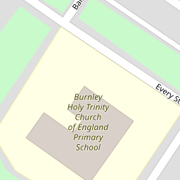
| Burnley Holy Trinity Church Of England Primary School | Voluntary Aided School | Good | 0.11 KM |
| Coal Clough Academy | Academy Alternative Provision Sponsor Led | Good | 0.62 KM |
| The Aspire Hub, Burnley | Other Independent Special School | Good | 0.88 KM |
| Sure Start South West Burnley Children'S Centre | Children's Centre | 0.92 KM | |
| Christ The King Roman Catholic Primary School, Burnley | Voluntary Aided School | Good | 0.93 KM |
Images
Nearby Streets
| Name | Average Price | Average Sqft | Distance |
|---|---|---|---|
| Piccadilly Road | £ 65,000 | 0 | 0.00 KM |
| Powell Street | £ 250,000 | 0 | 0.00 KM |
| Queen's Lancashire Way | £ 110,000 | 0 | 0.00 KM |
| Ward Street | £ 195,000 | 0 | 0.00 KM |
| Sackville Street | £ 0 | 0 | 0.00 KM |
Nearby Transport
| Name | NLC | TLC | Distance |
|---|---|---|---|
| Burnley Barracks | 2743 | BUB | 0.63 KM |
| Burnley Manchester Road | 2549 | BYM | 0.66 KM |
| Burnley Central | 2550 | BNC | 1.33 KM |
| Rose Grove | 2722 | RSG | 3.11 KM |
| Brierfield | 2554 | BRF | 4.64 KM |
Nearby Listings
| Address | Price | Type | Score | Distance |
|---|---|---|---|---|
| Palatine Square, Burnley, BB11 | £ 450,000 | BUY | 7 / 10 | 0.05 KM |
| Piccadilly Road, Burnley | £ 49,995 | BUY | 4 / 10 | 0.09 KM |
| 55 Piccadilly Road, Burnley, BB11 4PU | £ 20,000 | BUY | Unknown | 0.10 KM |
| Grange Street, Burnley | £ 75,000 | BUY | 6 / 10 | 0.12 KM |
| Grange Street, Burnley | £ 79,950 | BUY | 6 / 10 | 0.13 KM |
Nearby Properties
| Address | Price | Distance |
|---|---|---|
| 12 Raglan Road | £ 45,000 | 0.00 KM |
| 12 Willis Street | £ 43,000 | 0.09 KM |
| 2 Ellis Street | £ 42,500 | 0.10 KM |
| 4 Ellis Street | £ 51,000 | 0.10 KM |
| 2a Ellis Street | £ 60,000 | 0.10 KM |